
Topographic Survey Planning for Lots With Drainage Problems
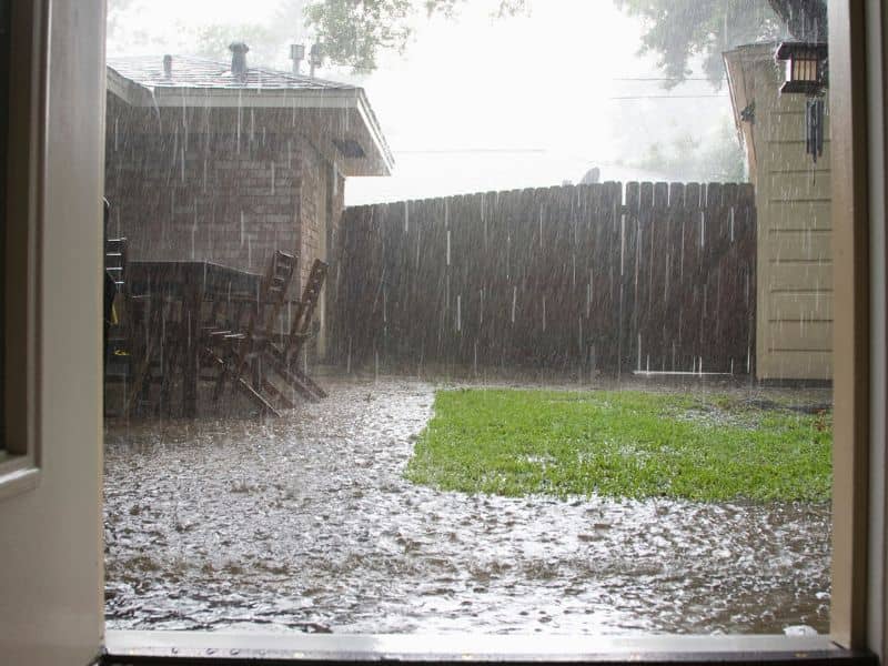
Water always finds the low spot. On some lots, that low spot is your crawl space, your driveway, or your neighbor’s backyard. A topographic survey shows how the ground slopes, where water collects, and which structures move it along. That map only helps if it’s planned around the real problem, though. When you define the issue early, set the right survey limits, and share the data with your designer, you get a map that leads to a lasting fix instead of a second site visit.
Defining the Drainage Problem Before the Topographic Survey
Start by writing down what you’ve seen. A topographic survey maps elevations, slopes, and surface features, but your surveyor needs to know what question the map should answer. Note where water ponds, how long it stays, and which storms cause the most trouble. Photos taken during or right after heavy rain are some of the most useful things you can hand over.
Next, tell the surveyor who will use the survey and why. A homeowner fixing a soggy yard needs different detail than a builder preparing a grading plan or an engineer designing a stormwater system. The purpose shapes how many elevations get measured and how closely the contour lines are spaced. A contour line connects points at the same elevation, and tighter spacing, such as 1 foot, shows the gentle slopes that often cause trouble on flat, wet lots.
Gather these items before you call:
- Photos or videos of standing water, erosion, or wet basements
- Dates of the worst storms and how the lot responded
- Older surveys, plats, or site plans
- Records of past fixes, such as regrading, French drains, or new gutters
- Notes on complaints from neighbors or the local permit office
Setting the Survey Area Beyond Visible Problem Spots
The survey area should include the land that sends water toward the problem and the path that carries it away. A wet corner is usually a symptom. The cause may sit uphill on your lot, across a property line, or in a street gutter that pushes runoff your way.
Ask the surveyor to pick up grades past the property line when it makes sense. Surveyors can’t always enter neighboring land, so off-site coverage may be limited to what can be measured from your side or from the public right-of-way. Spot elevations along the edges, the street, and the nearest ditch or inlet help show the full flow path. Settle this during scoping, because adding coverage later usually means another trip to the site.
Think about the outfall too. The outfall is where water leaves the site, such as a ditch, storm pipe, creek, or street. A drainage fix only works if water has somewhere lower to go, and the survey should confirm that this lower point exists and how much lower it is.
Documenting Drainage Structures and Site Improvements
A drainage-focused topographic survey should locate every feature that moves, blocks, or holds water. That list includes inlets, catch basins, pipes, culverts, swales, ditches, downspouts, and retaining walls. Buildings, driveways, patios, fences, and landscape beds matter as well because they change how runoff travels.
For pipes and structures, ask for invert elevations. The invert is the inside bottom of a pipe, where the water actually flows. Inverts show whether a pipe slopes the right direction and has enough fall to drain. A pipe that looks fine from the surface can sit flat or even run backward underground.
Finished floor elevations deserve a spot on the map. These include the main floor, the garage slab, and any crawl space vents or basement openings. They tell your designer how much room exists between the ground and the building, and they’ll show in plain numbers if soil near the foundation is too high or slopes toward the house.
Underground utilities can shape the fix in ways people don’t expect. A new drain line or regraded swale may run into gas, water, or sewer lines. Surveyors often show utilities based on visible features and marks from a utility locate request, and the level of detail can vary by project. Ask up front what utility information your survey will include.
Coordinating Topographic Survey Data With Drainage Design
Bring your designer into the conversation before fieldwork starts. The engineer, landscape contractor, or grading contractor who designs the fix should review the survey scope. They may ask for extra elevations, cross sections of a swale, or a specific elevation reference system.
That reference system is called a datum, and it sets the starting point for every elevation on the map. Some small projects use an assumed elevation, while others tie into a public vertical datum such as NAVD 88. If the work may need a permit or connect to a public storm system, a tied datum is often expected, though requirements vary by municipality, county, and project scope. Confirm this early so the survey doesn’t need to be redone.
Ask for the right files as well. Many designers want a CAD file and a digital surface model along with the signed PDF. A surface model is a 3D version of the ground that lets a designer test grading options on screen. Getting these files at the start saves time and cuts down on errors from redrawing.
Planning Follow-Up Surveying After Drainage Improvements
A follow-up survey checks whether the finished work matches the design. It’s often called an as-built survey. It records final grades, pipe inverts, and structure locations after construction wraps up.
Small misses matter a lot on drainage work. A swale built an inch too high or a pipe laid with too little slope can bring back the same ponding the project was meant to solve. Some permits, lenders, or local offices may require as-built data, and that need can vary by jurisdiction and project type. Even when it isn’t required, the record helps with future repairs, a later sale, or a disagreement with a neighbor.
Plan the follow-up before the contractor starts. Pipes and structures are easiest to measure before they’re buried, so timing your surveyor’s visit with the construction schedule is smart. Walking the site after a few heavy rains adds a practical check that pairs well with the survey data.