
Can a Boundary Survey Determine Which Stream Buffer Controls Your Buildable Area?
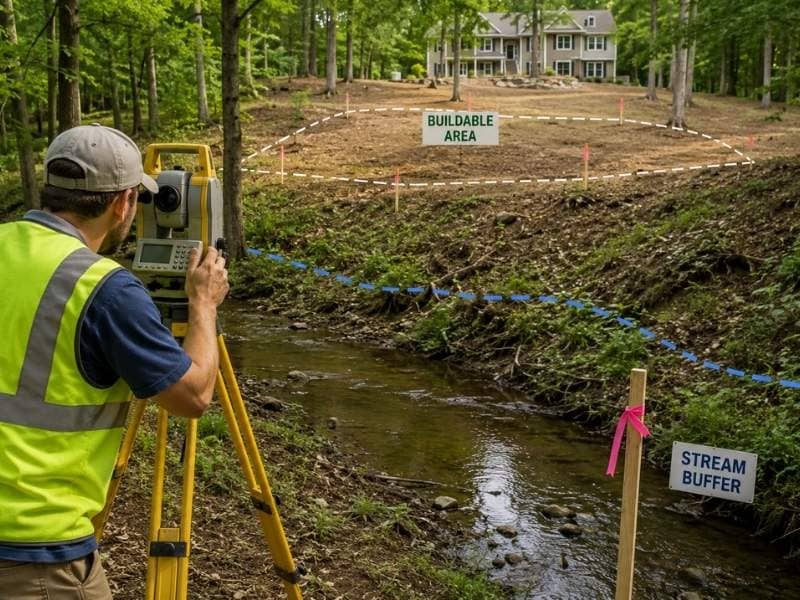
A stream running through your land can quietly shrink where you are allowed to build, and a boundary survey is how you learn by how much. Local rules often require a protected strip along the water, measured from a specific feature that most owners cannot spot on their own. To know your real building room, you first need the property lines drawn correctly, then the buffer laid over them. Only then does the usable area come into focus. Guessing at any of it can leave a foundation stranded inside a zone where construction is simply off limits.
Locating the Parcel Limits Before Environmental Lines Are Applied
The buffer means little until the property itself is nailed down. If the outer lines sit a few feet off, every measurement taken from them inherits the same error, buffer included.
So the surveyor settles the boundary before touching anything environmental. Recovered corners and recorded deeds set the frame, and only then does the regulated strip get measured against a line you can trust. Order matters here, because a rushed buffer drawn over a shaky boundary helps no one and can push the design in the wrong direction.
Waterfront parcels tend to have the messiest histories, with old deeds that describe the line by the water’s edge as it sat generations ago. Since water moves over time, that wording may no longer match today’s bank, and the surveyor has to reconcile the two. Settling the boundary first gives every later measurement a fair chance of being right.
Identifying the Field Feature From Which the Buffer Begins
Buffers do not start from the water in general. Rules usually pick a precise starting feature, such as the top of the streambank or the edge of the channel, and the whole protected strip runs from there.
Finding that feature in the field takes a trained eye, because banks erode, shift and hide under brush. The surveyor locates the controlling edge and marks it, since a mistake of even a few feet drags the entire buffer along with it. A GPS-guided instrument can record that edge precisely, but only after the surveyor decides which edge the rule actually means.
Some codes name a wetland limit or a floodway edge as the starting feature instead of the bank, which changes the whole calculation. Part of the job is confirming which feature the local rule points to before a single distance gets measured. Read that wrong, and every number downstream quietly inherits the mistake.
Plotting Recorded Restrictions Beside Regulatory Setbacks
Two different kinds of limits often crowd a waterfront lot, and they do not always agree. One set comes from documents recorded against the deed, and the other comes from local rules that apply to every property near the water.
The survey draws both so the owner can see the full squeeze:
- Conservation areas written into the deed or a prior plat
- Buffer strips required by current local rules
- Standard yard setbacks that apply no matter where the stream sits
Where these overlap, the strictest one usually wins, and the drawing shows that at a glance instead of leaving it to a bad assumption. That single view can save an owner from buying a lot expecting far more room than the rules will ever grant.
Revealing Where the Proposed Footprint Conflicts With the Corridor
With the lines and buffers in place, the planned building goes onto the same drawing. Now anyone can see whether a corner of the house pokes into the protected corridor or clears it with room to spare.
This overlap view saves a designer from falling for a layout that can never win a permit. If the footprint crosses the line, the plan can slide, rotate or shrink before anyone spends money on detailed drawings. Seeing the conflict at this stage costs almost nothing, while learning about it from a denial costs weeks.
The check often reshapes the whole site plan, not just the house. Driveways, septic areas and even a shed may need to move once the corridor is drawn, and seeing all of it together lets the owner make one set of decisions instead of a dozen scattered ones.
Defining the Remaining Land for Design Evaluation
After the constraints come off the top, what remains is the ground actually open for building. The survey shades or outlines that leftover area so architects and engineers know their true canvas.
The surveyor stops there, though, and does not rule on whether a given design will win approval. That decision belongs to the reviewing authority. What the survey provides is an honest map of the room available, which keeps the whole design grounded in reality from the very first sketch.
A clear picture of the buildable area also steers early talks with a designer toward plans that can actually happen. Nobody burns weeks chasing a footprint the rules would never allow, and the owner starts from solid ground instead of wishful thinking.
Frequently Asked Questions
Does a property line always follow the stream?
No. A deed boundary and the water can sit in different spots, and the two are easy to confuse. The recorded line controls ownership, while the stream mainly drives the buffer.
Can the surveyor decide whether a buffer variance will be approved?
No. The surveyor maps the features and measurements, but the agency in charge rules on any variance request. Those are two separate roles.
Will seasonal water affect the field location?
It can. High or low water changes what the crew sees on a given day, so the surveyor may lean on records and professional evidence to fix the controlling feature reliably.