
Which Flood Line Should an Elevation Certificate Follow for New Residential Construction?
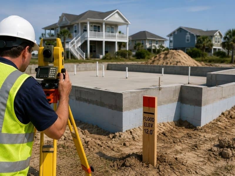
An elevation certificate and a flood map look like they measure the same thing, but they answer very different questions for a new home. The map sorts a whole community into zones, while the certificate reports the exact heights of one building and its ground. A builder who mixes them up can set a floor to the wrong target and pay for it later. Knowing which flood line actually governs the project keeps the design aimed at the right number from day one. Both belong in the process, and each does a job the other cannot.
Distinguishing Mapped Flood Limits From Measured Building Heights
A flood map paints in wide strokes. It groups land into zones and shows a general water level a community plans around, but it never measures your particular slab or doorstep.
The certificate does the close-up work. It reports real heights taken in the field and lines them up against the level the map calls for. One tool sets the rule, and the other proves whether the house meets it. Treating one as a stand-in for the other is where costly mistakes usually begin.
This trips up plenty of first-time builders, who assume a low-risk zone on the map means their slab is automatically safe. The zone is only a starting point. The certificate is what proves, in hard numbers, whether the specific floor sits where it should.
Confirming the Flood Information Required for the Specific Parcel
Before any height gets measured, the right flood data for that exact address has to be confirmed. Communities are split into map panels, each with its own zone lines and effective date, and picking the wrong panel can send the whole design off course.
The surveyor checks the panel, the zone and the governing water level that apply to the parcel in question. This sounds like simple paperwork, but it decides the entire target the builder aims for. A floor built to an outdated panel or a neighboring zone can miss by a wide margin, and that error is expensive to undo once concrete is down.
Maps also get updated, and a panel that was current last year may already be replaced by a newer one with different lines. The surveyor confirms the effective version rather than trusting an old copy, since building to a retired map invites trouble at permit time. A few minutes of checking here prevents a very costly redo.
Setting a Foundation Reference Before Vertical Work Starts
Once the target height is clear, crews need a dependable mark on site to build against. The surveyor sets a reference point the framing team can check as the foundation and first floor take shape. That small mark ends up doing a surprising amount of heavy lifting on site.
The reference keeps everyone honest as walls rise off the slab. Without it, a floor can creep high or low while no one notices until fixing it costs real money. A steady point on the ground turns the paper target into a height a carpenter can actually hit.
It also gives inspectors and lenders a common point to trust later. When the final certificate lands on someone’s desk, every height on it traces back to that same mark, which makes the whole document easier to defend. Small anchors like this quietly hold a big project together.
Measuring the Structure at the Required Building Stage
Not every part of the certificate can be filled in at the same moment. Some entries only make sense to measure once the structure reaches a certain point in the build.
Early on, the surveyor can certify proposed heights from the plans and the graded ground. Later, after the floor is in and the shell stands, a field visit records what was truly built. Matching each measurement to the right stage keeps the numbers accurate rather than hopeful.
Trying to shortcut the timing usually backfires. Certify too early and the numbers describe a house that does not exist yet. Wait too long and a missed reading can hold up a closing. Good scheduling puts each visit exactly where it belongs.
Resolving Differences Between Design Documents and Field Results
Plans and reality do not always agree. A slab can finish an inch high, or fill can settle, and the field numbers then part ways with what the drawings promised.
When that happens, the certificate reports what the survey actually found, not what the design hoped for. The surveyor flags the gap so the responsible professionals can decide whether it matters or needs a fix. Honest field data beats a tidy plan every time, because the record has to match the home that got built.
None of this means the plans were bad. Construction simply carries small surprises, and a solid certificate absorbs them by telling the truth about the finished building. That honesty is what lets insurers, lenders and officials rely on the document without second-guessing it.
Frequently Asked Questions
Can two flood boundaries affect the same property?
Yes. A single parcel can fall under more than one mapped or locally set flood line, each with its own effect. The survey shows how they overlap so nothing gets missed.
Does the Elevation Certificate choose the construction height?
No. It records the heights that exist and reports them against the required level. The target itself comes from the design and the rules that apply, not from the certificate.
Can the certificate be prepared from architectural drawings alone?
Only the proposed version leans on plans. A completed certificate needs real field measurements, since a finished house rarely matches its drawings perfectly.