↓
 

Charlotte Land Surveyor

...a Pro17 Engineering marketing website.

Charlotte Land Surveyor
  • Home
  • ALTA Survey
  • Boundary Surveying
  • Construction Survey
  • Drone LiDAR Mapping
  • Elevation Certificate
  • Land Surveying
  • Lot Survey – Closing Survey
  • Topographic Survey
  • Blog
  • Contact Us
Home→elevation certificate→Difference in FEMA Elevation Certificate and LOMA →GIS with Flood Hazard Zone Overlay

Image navigation

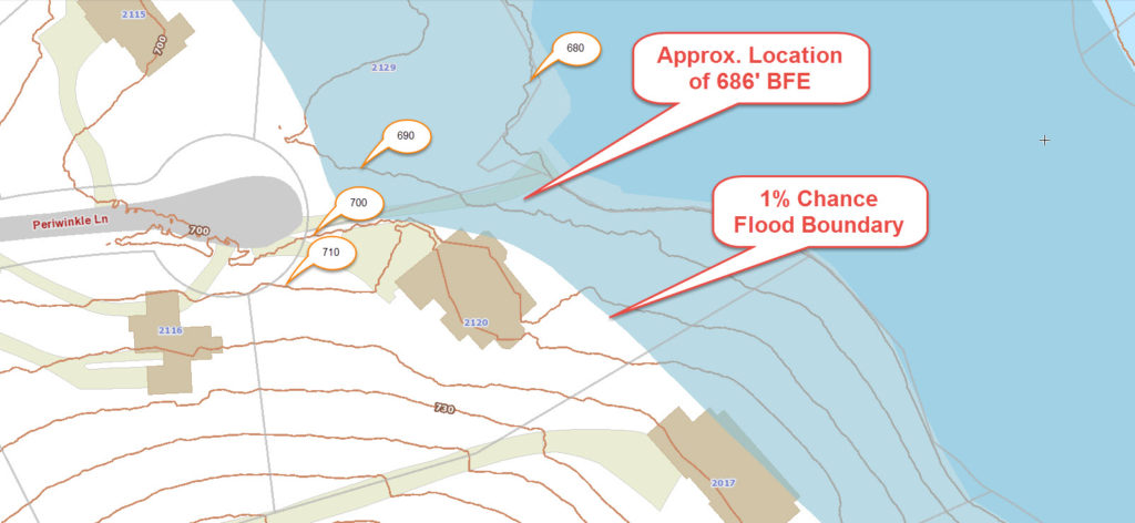
GIS with Flood Hazard Zone Overlay

Published March 6, 2016 at 1024 × 472 in Difference in FEMA Elevation Certificate and LOMA

Image navigation

Search This Site

Get Quote Button

Recent Posts

  • ALTA Survey Issues That Can Slow Down Commercial Closings
  • Why a Boundary Survey Matters Before Replacing an Old Fence
  • What a Topographic Survey Shows and When You Need One
  • What Is an ALTA Survey and Who Actually Needs One?
  • Boundary Survey Cost: Prices and What Affects Them
© Copyright Charlotte Land Surveyor
Charlotte, NC
Phone:(704) 285-1222

Privacy Policy | Terms of Use

Web Development and SEO by:
N2Biz.co

Privacy Policy | Terms of Use

↑