
Boundary Survey Cost: Prices and What Affects Them
A boundary survey cost question usually comes up right when something important is about to happen. You’re closing on a property, planning a fence, or dealing with a disagreement over where your lot ends and your neighbor’s begins. Either way, you want a real number before you commit to anything.
A boundary survey for a standard residential lot typically runs between $500 and $1,200. That range covers most single-family properties under one acre. Larger lots, commercial parcels, and anything with a complicated ownership history will push the price higher.
Here’s what that price actually buys, when you need one, and why the cost varies the way it does.
What a Boundary Survey Actually Is
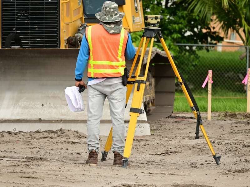
A boundary survey is a formal legal document. It determines and certifies the exact location of a property’s boundaries based on recorded deeds, legal descriptions, and physical evidence found on the ground.
The surveyor pulls historical records first. That means deeds, recorded plats, prior survey documents, and sometimes old chain-of-title records going back decades. Then the field crew goes out and locates physical evidence: existing monuments, iron pins, concrete markers, and reference points from neighboring lots.
When the fieldwork is done, the surveyor reconciles what the documents say with what the ground shows. The result is a certified plat or map showing the confirmed boundary lines, corner locations, and any easements or encroachments the survey identified.
That document carries legal weight. It’s what title companies rely on, what lenders ask for, and what holds up if a boundary dispute ever goes to court.
When You Actually Need a Boundary Survey
Not every property situation requires one, but there are several common triggers where getting one is either required or strongly advisable.
Real estate transactions. Some lenders and title companies require a current boundary survey before closing. Even when it isn’t required, buyers often order one independently to confirm that what they’re purchasing matches what the deed describes.
Adding a fence, wall, or outbuilding. Before any structure goes up along or near a property line, a boundary survey confirms exactly where that line sits. The existing fence already on the lot may not be accurate. Many fences are built on assumptions, not on surveyed lines.
Resolving a neighbor dispute. When two property owners disagree about where one lot ends and another begins, a boundary survey provides the legally defensible answer. It doesn’t resolve every dispute, but it replaces opinion with documented fact.
Subdividing land. Any time a parcel gets divided into smaller pieces, a licensed surveyor must establish the new boundary lines. This is a legal requirement in most states, and the boundary survey is the foundation that makes the recorded plat possible.
Permitting and zoning compliance. Some municipalities require proof of boundary location before issuing permits for additions, pools, or detached structures. A boundary survey satisfies that requirement.
What Drives Boundary Survey Price Up or Down
The $500 to $1,200 range covers a lot of ground. Understanding where within that range a specific property falls comes down to a handful of variables.
How clear the legal description is. Properties described in metes and bounds, common in older subdivisions and rural lots, require more research to interpret than a simple lot and block description in a modern platted subdivision. Older legal descriptions sometimes contain gaps, ambiguities, or reference points that no longer exist on the ground. Sorting those out takes time.
Number of corners and boundary segments. A rectangular lot with four corners is straightforward. A lot with eight or ten corners, curved frontage, or a boundary that follows a natural feature like a creek takes more time to survey and more work to document accurately.
Whether prior monuments exist. When iron pins and concrete monuments from a prior survey are still in place and verifiable, the fieldwork moves faster. When they’ve been disturbed, buried, or removed over time, the crew has to re-establish corners from other reference points. That adds both time and cost.
Disputed or unclear title history. If a property has changed hands many times, went through a foreclosure, or has a break somewhere in the ownership chain, the research phase gets longer. A surveyor has to trace every relevant deed and document to build a complete legal picture before fieldwork can begin.
Lot size and boundary perimeter. Larger lots with longer boundary lines simply take more time to survey in the field. A half-acre suburban lot takes far less time than a five-acre rural parcel, even if both appear uncomplicated on paper.
Boundary Survey Price vs. What You Get
It helps to think about the boundary survey price in terms of what the document produces, not just what the fieldwork involves.
A completed boundary survey gives you a certified, legally defensible record of your property’s exact boundaries. That document becomes part of the public record when recorded. It protects against future disputes. It supports financing, permitting, and title insurance. And it travels with the property, meaning the next owner benefits from it too.
For context, the price of a boundary survey is a fraction of what a boundary dispute costs to resolve through legal action, which can run into thousands of dollars once attorney fees and court time are involved. Getting the lines documented correctly at the start is almost always cheaper than fixing a problem later.
Frequently Asked Questions
What is the difference between a boundary survey and a property survey?
The terms are often used interchangeably. A property survey is a general term that can refer to several survey types. A boundary survey specifically determines and certifies the legal boundary lines of a parcel. If someone asks you for a property survey, ask which type they mean.
Does a boundary survey establish new property lines or confirm existing ones?
In most cases, a boundary survey confirms and documents the legal boundary lines that already exist based on recorded deeds and prior surveys. It doesn’t create new lines. If boundaries need to be changed, that requires a separate legal process, often involving a recorded plat or boundary line adjustment.
Who pays for a boundary survey in a real estate transaction?
That depends on the contract. In some transactions, the seller orders a survey before listing. In others, the buyer orders one as part of due diligence. Lenders sometimes require it as a condition of financing. It’s a negotiable item, and who pays is typically agreed upon before closing.
How accurate is a boundary survey?
A boundary survey conducted by a licensed professional surveyor follows state standards for accuracy and is legally certified. The precision involved depends on the survey method used and the instruments employed. Modern surveys using GPS equipment and total stations achieve a very high level of accuracy.
Does a boundary survey show easements?
Yes. A boundary survey typically identifies and documents recorded easements that affect the property, such as utility easements, drainage easements, and access rights. Unrecorded easements, meaning those that exist by use but were never formally documented, may not appear unless the surveyor has reason to investigate further.
Can a boundary survey be used for a mortgage or refinance?
It depends on the lender and the type of loan. Some lenders accept a current boundary survey in place of a full mortgage survey. Others require a specific survey type or certification. Check with your lender before ordering to make sure the survey you commission meets their requirements.