
Land Surveying Supports Infill Development on Tight Urban Lots
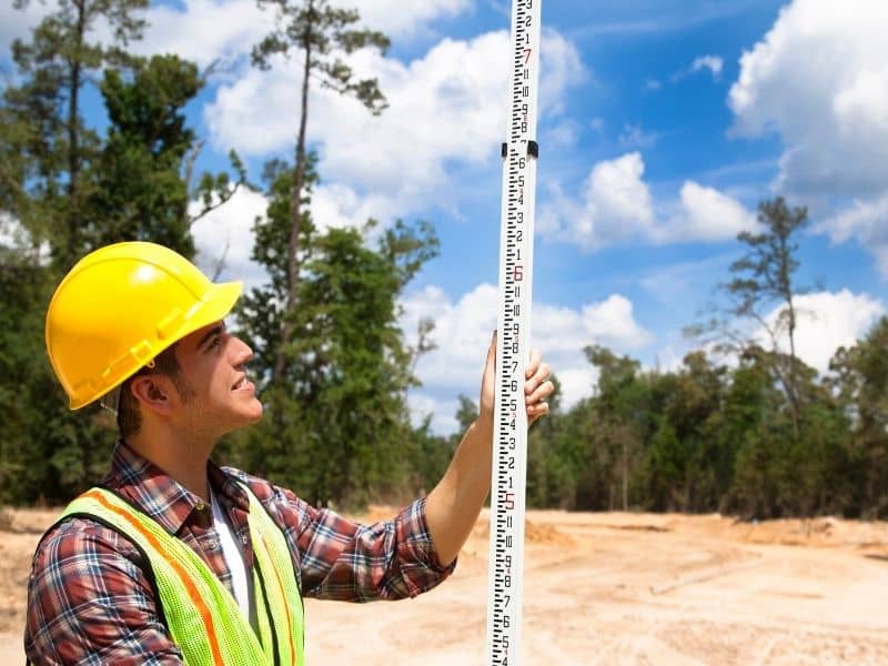
Building on an empty lot in the middle of a city sounds straightforward until the work actually begins. Infill development means building on unused or underused land within an existing neighborhood, and it comes with real challenges that most suburban projects never face. The lot might be narrow, oddly shaped, or boxed in by neighboring buildings. Before any floor plan gets drawn, land surveying needs to happen first. Without it, the project team is working from guesses, and guesses on a tight urban lot are costly.
Why Infill Projects Begin With a Detailed Review of Existing Site Conditions
Most infill lots have a past. Old buildings may be gone, but what they left behind often isn’t. Concrete slabs, buried footings, retaining walls, and disconnected utility lines can sit under a lot that looks completely clear from the street. Once digging starts, those hidden conditions become very real problems very fast.
Land surveying gives the project team an accurate picture of what’s already there. Surveyors document pavement, drainage structures, curb lines, utility covers, fences, and nearby improvements on neighboring properties. That documented information becomes the starting point for every decision that follows. Designs built on assumptions tend to fall apart once ground is broken, and fixing them after the fact costs far more than getting it right at the start.
How Land Surveying Helps Identify Space Constraints Before Design Work Starts
A narrow lot can look workable on paper until you factor in setbacks, easements, and access limits. At that point, the actual buildable area shrinks quickly. On irregular parcels, those constraints can affect where the building sits, how large it can be, and how vehicles or people can enter and exit the site.
Survey data gives the team real dimensions before architects begin laying out floor plans. That early clarity means fewer redesigns, fewer problems during permit review, and a smoother path through the approval process. Knowing exactly how much space is available before design starts saves money and cuts down on back-and-forth with the planning department.
Locating Encroachments That Can Affect Urban Development Plans
Encroachments are common in dense urban areas. A neighbor’s fence might sit past the property line. Parking surfaces, signs, or utility equipment sometimes extend beyond where people expect the boundary to be. These conditions rarely show up in public records, and they’re easy to miss until they create a real problem.
Finding encroachments early gives the team time to deal with them before the design is finalized. When something sits in the space where a new structure needs to go, catching it during the survey phase allows for adjustments while options are still open. Catching it during construction means delays, redesigns, and added costs.
Some common encroachments surveyors find on infill sites include:
- Fences and walls that cross property lines
- Paved areas that extend onto or off the parcel
- Utility structures placed across boundaries
- Building overhangs or footings from adjacent structures
Supporting Accurate Building Placement in Areas With Limited Clearance
When a new building has to fit between two existing structures, placement has to be exact. A few inches off in the wrong direction can cause a setback violation or create a conflict with an adjacent building’s wall, foundation, or drainage system. Those errors tend to show up during inspection, and correcting them mid-construction is never cheap or quick.
Survey data gives architects and engineers the exact coordinates and elevations they need to place a structure correctly from day one. On tight lots, that level of accuracy isn’t a bonus feature. It defines the physical envelope the design has to fit within, and that envelope is usually tighter than a basic map makes it look.
Creating Reliable Base Mapping for Multi-Discipline Project Teams
Infill projects involve multiple teams working from the same drawings, including architects, civil engineers, structural engineers, planners, and contractors. When each team pulls from different data sources, or data that wasn’t collected carefully, coordination breaks down. Conflicts between systems get discovered in the field instead of on paper, and field fixes are expensive.
Survey-produced base mapping gives every discipline a shared reference. The same coordinates, elevations, and site features appear across all drawings because they all come from one accurate source. That shared foundation makes it easier for teams to work together, spot conflicts early, and avoid the kinds of last-minute changes that push schedules back and drive costs up.
Frequently Asked Questions
How does land surveying support infill development projects?
Surveying documents existing site conditions, boundaries, and physical features with accuracy. That data drives design decisions, permitting, and construction planning on urban lots where space is limited and errors are costly.
Why are existing site conditions important before redevelopment begins?
Older improvements, buried structures, and utility systems often remain on infill sites even after demolition. Knowing what’s there before design starts helps the team plan around real conditions, not assumptions.
Can land surveying help identify encroachments on urban properties?
Yes. Surveyors locate fences, paved surfaces, and structures in relation to property boundaries. When something crosses a line, the team can address it before it disrupts the design or delays construction.
What challenges do narrow lots create during project planning?
Narrow and irregular parcels reduce the space available for a new structure. Survey data helps teams understand those limits early so designs reflect what’s actually buildable, not just what the lot appears to offer on a map.
Who uses the survey data collected for infill development projects?
Architects use it to position and design structures. Civil and structural engineers use it for grading, drainage, and foundation work. Planners reference it during permit review, and contractors rely on it during construction to confirm placement and elevations.