
↓
 

Charlotte Land Surveyor

...a Pro17 Engineering marketing website.

Charlotte Land Surveyor
  • Home
  • ALTA Survey
  • Boundary Surveying
  • Construction Survey
  • Drone LiDAR Mapping
  • Elevation Certificate
  • Land Surveying
  • Lot Survey – Closing Survey
  • Topographic Survey
  • Blog
  • Contact Us
Home - Page 5 << 1 2 3 4 5 6 7 … 10 11 >>

Post navigation

← Older posts
Newer posts →

What a Topographic Survey Shows and When You Need One

Charlotte Land Surveyor Posted on June 18, 2026 by CharlotteLandSurveyorJune 11, 2026
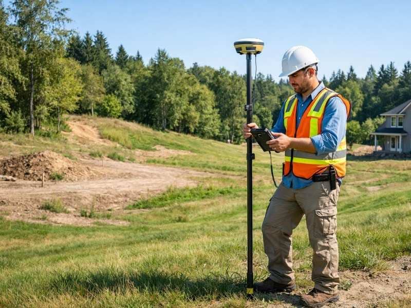
Land surveyor conducting a topographic survey to map elevation changes across a residential property

A topographic survey doesn’t come up in most conversations until a project requires one. Then suddenly everyone involved needs one, and nobody is quite sure what it produces. If you’re a homeowner, a land buyer, or someone planning to build, this article explains what a topographic survey is, what it shows, and when you’d actually need one.

What a Topographic Survey Actually Produces

A boundary survey focuses on property lines. A topographic survey focuses on what the land itself looks like. The finished product is a detailed map. It shows elevation changes across the site, contour lines that reveal slopes and grades, and the locations of features already on the property.

Those features usually include:

  • Trees and large vegetation
  • Buildings, sheds, and retaining walls
  • Utility poles, boxes, and surface access points
  • Fences and walls
  • Drainage channels, streams, and low spots
  • Roads and paved areas

Everything gets plotted at specific elevations. That means whoever is designing the project knows exactly what’s on the ground and how the land rises and falls from one point to another.

The drawing looks two-dimensional, but it holds three-dimensional information. Every point on the map has an elevation attached to it. That’s what makes it useful for engineering and design.

How a Topographic Survey Differs From a Boundary Survey

These two surveys serve different purposes. A lot of people assume they do the same thing. They don’t.

A boundary survey answers one question: where does this property begin and end?

A topographic survey answers a different question: what does the land inside those boundaries actually look like?

Both can be done at the same time. But ordering one doesn’t give you the other. If you need confirmed property lines, that’s a boundary survey. If you need elevation and terrain data for a design project, that’s a topographic survey. Many projects end up needing both.

When a Topographic Survey Becomes Necessary

Not every property owner needs one. It usually comes up when a project involves changes to the land, or when a designer needs to understand the terrain before making decisions.

New construction on raw land. Before an architect or engineer designs a home on an undeveloped lot, they need to know what the land looks like. The topographic survey gives them elevation data to position the building, plan drainage, and avoid surprises once construction starts.

Home additions and site improvements. Adding a pool, a large deck, a garage, or a major grading project may require one. Engineers use the elevation data to make sure new structures drain properly and don’t push water toward the existing home or neighboring properties.

Land development and subdivision. Developers planning to build multiple structures or divide land almost always need a topographic survey. Civil engineers use it to design roads, drainage systems, utility layouts, and grading plans for the whole site.

Steep or uneven terrain. On lots with significant slopes, a topographic survey is often essential before design work can begin. Slopes affect foundation type, driveway grade, and where water goes during heavy rain. Good elevation data prevents bad decisions from making it into the plans.

Drainage problems on existing properties. Homeowners with standing water, erosion, or recurring wet spots sometimes order one to understand exactly how water moves across their property. That data helps engineers design a drainage fix that actually works with how the land naturally flows.

What Happens During a Topographic Survey

The fieldwork looks different from a boundary survey. The crew isn’t just finding corners and marking lines. They’re collecting elevation data at many points across the entire site.

Surveyors use total stations and GPS equipment to measure elevations at regular intervals and at key features like high points, low points, and grade changes. The more data collected, the more accurate the contour map will be. On a small residential lot, this might take a few hours. On a larger parcel with varied terrain, it can take a full day or more.

Once the field data is processed, the surveyor produces the finished map. Contour lines get drawn at consistent elevation intervals, usually one foot or two feet apart depending on the terrain and what the project needs. That map goes to the engineer or architect as the base for all design work.

What the Finished Survey Map Looks Like

The finished topographic survey is a drawing that a design professional can use directly. It typically includes:

  • Property boundaries, if included in the scope
  • Spot elevations at key points across the site
  • Contour lines at the specified interval
  • All mapped features labeled and located
  • A legend, scale, and north arrow
  • The surveyor’s certification and seal

This drawing becomes the base map for site plans, grading plans, drainage designs, and architectural layouts. It’s where engineering work on a new project starts.

Survey mapping at this level requires a licensed professional surveyor. The certification on the finished drawing confirms the data was collected and processed to professional standards.

Frequently Asked Questions

What is a topographic survey used for? 

Engineers, architects, and builders use it to understand the shape of the land before designing a project. The elevation data and contour map guide decisions about building placement, drainage, grading, and earthwork.

How much does a topographic survey cost? 

Costs typically range from $400 to $1,500 for a standard residential lot. Size, terrain, and the level of detail required all affect the price. Larger parcels or heavily wooded sites cost more. The article on land survey cost has a full breakdown of survey pricing by type.

Do I need a topographic survey to get a building permit? 

It depends on your municipality and the scope of work. Some areas require topographic data as part of a permit application for grading, drainage, or new construction. Check with your local building or planning department before ordering.

How is a topographic survey different from a site plan? 

A topographic survey records what currently exists on the ground. A site plan is a design document that shows what is being proposed. The site plan is usually drawn on top of the topographic survey as the base layer.

Can a topographic survey be done at the same time as a boundary survey? 

Yes. Many survey firms offer both together. That’s often more efficient and cost-effective than ordering them separately. If your project needs both, ask about a combined scope when requesting a quote.

How long does a topographic survey take? 

Fieldwork on a standard residential lot usually takes a few hours to a full day, depending on size and terrain. Processing and drafting the finished map adds several more business days. Most residential topographic surveys are completed within one to two weeks from the order date.

Posted in topographic survey | Tagged topographic survey

What Is an ALTA Survey and Who Actually Needs One?

Charlotte Land Surveyor Posted on June 15, 2026 by CharlotteLandSurveyorJune 11, 2026
Land surveyor reviewing site plans during an ALTA survey for a commercial property.

If you’ve heard the term ALTA survey come up during a property deal and didn’t know what it meant, you’re not alone. It gets used a lot in real estate without much explanation. 

An ALTA survey is a type of land survey that follows a national standard used across the United States. It’s more detailed than a regular boundary survey. It comes up most often in commercial real estate deals. Knowing what it covers and when it’s required can save you a lot of confusion.

What Makes an ALTA Survey Different From a Standard Boundary Survey

A standard boundary survey confirms where a property’s boundary lines are. It’s the most common type used for residential properties. It covers the basics: property lines, corner locations, and a certified plat.

An ALTA survey does all of that, but goes further. It follows a set of rules published by the American Land Title Association and the National Society of Professional Surveyors. Those rules define a level of detail that’s the same no matter which state the property is in.

The extra detail matters. An ALTA survey documents boundary lines, existing buildings and structures, recorded easements, visible encroachments, access to the property, and other conditions that affect how the land can be used. A licensed surveyor certifies all of it.

The result is a document that title companies, lenders, and attorneys trust. Because the standard is the same across all fifty states, everyone involved in a deal knows exactly what they’re getting.

Who Usually Requires an ALTA Survey

In most cases, the lender or title company is the one asking for it. Commercial lenders generally won’t approve financing without one. Title underwriters often require one before issuing extended coverage on a title policy.

Here’s a simple breakdown of who gets involved and why:

Commercial lenders. A lender needs to know that the buildings on a property sit within the correct boundary lines, that legal access exists, and that no easements or encroachments create a problem with the collateral. A standard boundary survey doesn’t cover all of that. An ALTA survey does.

Title companies. When a title company removes certain exceptions from a title policy, they need field-verified proof that no boundary, easement, or encroachment issues exist. The ALTA survey provides that proof.

Commercial buyers. Even when it isn’t required, buyers in large commercial deals often order one as part of their review process. It gives them a full picture of the property before the deal closes.

Developers. Before committing to a site plan or budget, a developer needs to know exactly what easements cross the property, where the boundary lines sit, and what physical conditions exist on the ground. An ALTA survey answers all of those questions.

What an ALTA Survey Actually Documents

Every ALTA survey covers a defined set of items. Some are standard on every survey. Others are optional additions called Table A items, which the client can request based on what the deal requires.

Standard items include:

  • Boundary lines and confirmed corner locations
  • Buildings, parking areas, and other structures on the property
  • Recorded easements and rights-of-way
  • Visible encroachments across boundary lines in either direction
  • Evidence of access to a public road
  • Utility lines visible on the surface

Optional Table A items can include things like flood zone classification, zoning setback information, parking counts, and gross land area. These get added based on what the lender, title company, or buyer specifically needs.

How Long an ALTA Survey Takes

An ALTA survey takes longer than a standard residential boundary survey. Most are completed within ten to twenty business days from the time the order is placed. Large sites or those with complex ownership histories can take longer.

There are two reasons for the longer timeline. First, the fieldwork itself is more detailed. Second, the office research takes more time. The surveyor has to review title commitments, recorded easements, deed history, and prior survey documents before fieldwork even begins.

In busy markets, survey firms often have full order books. Ordering early in the process gives you time to deal with anything the survey finds. Waiting until the last minute doesn’t.

Does a Home Buyer Ever Need an ALTA Survey

Most residential buyers don’t. A standard boundary or mortgage survey is usually enough for what a residential lender requires.

That said, there are a few situations where a home buyer might run into an ALTA requirement. High-value homes with complicated title histories sometimes trigger it. Mixed-use properties that combine residential and commercial use may need one too. Buyers purchasing raw land for future development sometimes order one on their own as part of due diligence.

If you’re buying a single-family home and your lender asks for a survey, they almost always mean a boundary survey. If the word ALTA comes up specifically, check with your lender or title company before ordering anything.

Posted in alta survey | Tagged alta survey

Boundary Survey Cost: Prices and What Affects Them

Charlotte Land Surveyor Posted on June 12, 2026 by CharlotteLandSurveyorJune 11, 2026
Property surveyor performing a boundary survey cost assessment using surveying equipment on a residential lot

A boundary survey cost question usually comes up right when something important is about to happen. You’re closing on a property, planning a fence, or dealing with a disagreement over where your lot ends and your neighbor’s begins. Either way, you want a real number before you commit to anything.

A boundary survey for a standard residential lot typically runs between $500 and $1,200. That range covers most single-family properties under one acre. Larger lots, commercial parcels, and anything with a complicated ownership history will push the price higher.

Here’s what that price actually buys, when you need one, and why the cost varies the way it does.

What a Boundary Survey Actually Is

A boundary survey is a formal legal document. It determines and certifies the exact location of a property’s boundaries based on recorded deeds, legal descriptions, and physical evidence found on the ground.

The surveyor pulls historical records first. That means deeds, recorded plats, prior survey documents, and sometimes old chain-of-title records going back decades. Then the field crew goes out and locates physical evidence: existing monuments, iron pins, concrete markers, and reference points from neighboring lots.

When the fieldwork is done, the surveyor reconciles what the documents say with what the ground shows. The result is a certified plat or map showing the confirmed boundary lines, corner locations, and any easements or encroachments the survey identified.

That document carries legal weight. It’s what title companies rely on, what lenders ask for, and what holds up if a boundary dispute ever goes to court.

When You Actually Need a Boundary Survey

Not every property situation requires one, but there are several common triggers where getting one is either required or strongly advisable.

Real estate transactions. Some lenders and title companies require a current boundary survey before closing. Even when it isn’t required, buyers often order one independently to confirm that what they’re purchasing matches what the deed describes. 

Adding a fence, wall, or outbuilding. Before any structure goes up along or near a property line, a boundary survey confirms exactly where that line sits. The existing fence already on the lot may not be accurate. Many fences are built on assumptions, not on surveyed lines. 

Resolving a neighbor dispute. When two property owners disagree about where one lot ends and another begins, a boundary survey provides the legally defensible answer. It doesn’t resolve every dispute, but it replaces opinion with documented fact.

Subdividing land. Any time a parcel gets divided into smaller pieces, a licensed surveyor must establish the new boundary lines. This is a legal requirement in most states, and the boundary survey is the foundation that makes the recorded plat possible.

Permitting and zoning compliance. Some municipalities require proof of boundary location before issuing permits for additions, pools, or detached structures. A boundary survey satisfies that requirement.

What Drives Boundary Survey Price Up or Down

The $500 to $1,200 range covers a lot of ground. Understanding where within that range a specific property falls comes down to a handful of variables.

How clear the legal description is. Properties described in metes and bounds, common in older subdivisions and rural lots, require more research to interpret than a simple lot and block description in a modern platted subdivision. Older legal descriptions sometimes contain gaps, ambiguities, or reference points that no longer exist on the ground. Sorting those out takes time.

Number of corners and boundary segments. A rectangular lot with four corners is straightforward. A lot with eight or ten corners, curved frontage, or a boundary that follows a natural feature like a creek takes more time to survey and more work to document accurately.

Whether prior monuments exist. When iron pins and concrete monuments from a prior survey are still in place and verifiable, the fieldwork moves faster. When they’ve been disturbed, buried, or removed over time, the crew has to re-establish corners from other reference points. That adds both time and cost.

Disputed or unclear title history. If a property has changed hands many times, went through a foreclosure, or has a break somewhere in the ownership chain, the research phase gets longer. A surveyor has to trace every relevant deed and document to build a complete legal picture before fieldwork can begin.

Lot size and boundary perimeter. Larger lots with longer boundary lines simply take more time to survey in the field. A half-acre suburban lot takes far less time than a five-acre rural parcel, even if both appear uncomplicated on paper.

Boundary Survey Price vs. What You Get

It helps to think about the boundary survey price in terms of what the document produces, not just what the fieldwork involves.

A completed boundary survey gives you a certified, legally defensible record of your property’s exact boundaries. That document becomes part of the public record when recorded. It protects against future disputes. It supports financing, permitting, and title insurance. And it travels with the property, meaning the next owner benefits from it too.

For context, the price of a boundary survey is a fraction of what a boundary dispute costs to resolve through legal action, which can run into thousands of dollars once attorney fees and court time are involved. Getting the lines documented correctly at the start is almost always cheaper than fixing a problem later.

Frequently Asked Questions

What is the difference between a boundary survey and a property survey? 

The terms are often used interchangeably. A property survey is a general term that can refer to several survey types. A boundary survey specifically determines and certifies the legal boundary lines of a parcel. If someone asks you for a property survey, ask which type they mean.

Does a boundary survey establish new property lines or confirm existing ones? 

In most cases, a boundary survey confirms and documents the legal boundary lines that already exist based on recorded deeds and prior surveys. It doesn’t create new lines. If boundaries need to be changed, that requires a separate legal process, often involving a recorded plat or boundary line adjustment.

Who pays for a boundary survey in a real estate transaction? 

That depends on the contract. In some transactions, the seller orders a survey before listing. In others, the buyer orders one as part of due diligence. Lenders sometimes require it as a condition of financing. It’s a negotiable item, and who pays is typically agreed upon before closing.

How accurate is a boundary survey?

 A boundary survey conducted by a licensed professional surveyor follows state standards for accuracy and is legally certified. The precision involved depends on the survey method used and the instruments employed. Modern surveys using GPS equipment and total stations achieve a very high level of accuracy.

Does a boundary survey show easements? 

Yes. A boundary survey typically identifies and documents recorded easements that affect the property, such as utility easements, drainage easements, and access rights. Unrecorded easements, meaning those that exist by use but were never formally documented, may not appear unless the surveyor has reason to investigate further.

Can a boundary survey be used for a mortgage or refinance? 

It depends on the lender and the type of loan. Some lenders accept a current boundary survey in place of a full mortgage survey. Others require a specific survey type or certification. Check with your lender before ordering to make sure the survey you commission meets their requirements.

Posted in boundary surveying | Tagged boundary survey, boundary surveying

Post navigation

← Older posts
Newer posts →

Search This Site

Get Quote Button

Recent Posts

  • Construction Survey Layout for Dense Housing Projects
  • Topographic Survey Insights for Drainage Sensitive Sites
  • Boundary Survey Reviews Are Increasing Across Long-Held Properties
  • Thinking About a Backyard Addition? Get a Boundary Survey First
  • How Builders Use Topographic Surveys to Reduce Grading Costs
© Copyright Boxer Survey USA
Charlotte Land Surveyor

Charlotte, NC
Phone:(704) 285-1222

Privacy Policy | Terms of Use

Web Development and SEO by:
AuburnBusiness.com, LLC

The owner of this website, Boxer Survey USA, provides coordination of professional land surveying and engineering services in all 50 states. The professional surveying and engineering services provided to you will be conducted by fully licensed professionals in your state.

↑