
↓
 

Charlotte Land Surveyor

...a Pro17 Engineering marketing website.

Charlotte Land Surveyor
  • Home
  • ALTA Survey
  • Boundary Surveying
  • Construction Survey
  • Drone LiDAR Mapping
  • Elevation Certificate
  • Land Surveying
  • Lot Survey – Closing Survey
  • Topographic Survey
  • Blog
  • Contact Us
Home - Page 4 << 1 2 3 4 5 6 … 10 11 >>

Post navigation

← Older posts
Newer posts →

Land Surveying Supports Infill Development on Tight Urban Lots

Charlotte Land Surveyor Posted on June 24, 2026 by CharlotteLandSurveyorJune 25, 2026
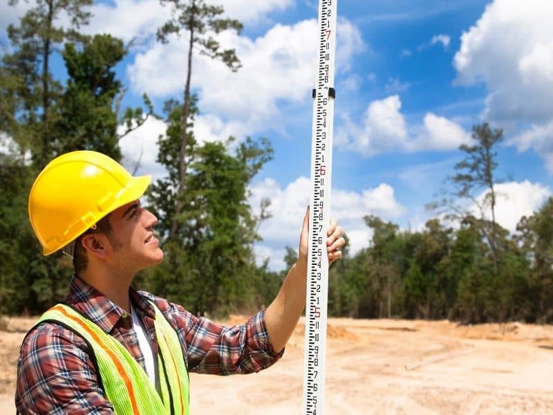
Land surveyor using a grade rod to collect site measurements during early-stage development planning and construction preparation.

Building on an empty lot in the middle of a city sounds straightforward until the work actually begins. Infill development means building on unused or underused land within an existing neighborhood, and it comes with real challenges that most suburban projects never face. The lot might be narrow, oddly shaped, or boxed in by neighboring buildings. Before any floor plan gets drawn, land surveying needs to happen first. Without it, the project team is working from guesses, and guesses on a tight urban lot are costly.

Why Infill Projects Begin With a Detailed Review of Existing Site Conditions

Most infill lots have a past. Old buildings may be gone, but what they left behind often isn’t. Concrete slabs, buried footings, retaining walls, and disconnected utility lines can sit under a lot that looks completely clear from the street. Once digging starts, those hidden conditions become very real problems very fast.

Land surveying gives the project team an accurate picture of what’s already there. Surveyors document pavement, drainage structures, curb lines, utility covers, fences, and nearby improvements on neighboring properties. That documented information becomes the starting point for every decision that follows. Designs built on assumptions tend to fall apart once ground is broken, and fixing them after the fact costs far more than getting it right at the start.

How Land Surveying Helps Identify Space Constraints Before Design Work Starts

A narrow lot can look workable on paper until you factor in setbacks, easements, and access limits. At that point, the actual buildable area shrinks quickly. On irregular parcels, those constraints can affect where the building sits, how large it can be, and how vehicles or people can enter and exit the site.

Survey data gives the team real dimensions before architects begin laying out floor plans. That early clarity means fewer redesigns, fewer problems during permit review, and a smoother path through the approval process. Knowing exactly how much space is available before design starts saves money and cuts down on back-and-forth with the planning department.

Locating Encroachments That Can Affect Urban Development Plans

Encroachments are common in dense urban areas. A neighbor’s fence might sit past the property line. Parking surfaces, signs, or utility equipment sometimes extend beyond where people expect the boundary to be. These conditions rarely show up in public records, and they’re easy to miss until they create a real problem.

Finding encroachments early gives the team time to deal with them before the design is finalized. When something sits in the space where a new structure needs to go, catching it during the survey phase allows for adjustments while options are still open. Catching it during construction means delays, redesigns, and added costs.

Some common encroachments surveyors find on infill sites include:

  • Fences and walls that cross property lines
  • Paved areas that extend onto or off the parcel
  • Utility structures placed across boundaries
  • Building overhangs or footings from adjacent structures

Supporting Accurate Building Placement in Areas With Limited Clearance

When a new building has to fit between two existing structures, placement has to be exact. A few inches off in the wrong direction can cause a setback violation or create a conflict with an adjacent building’s wall, foundation, or drainage system. Those errors tend to show up during inspection, and correcting them mid-construction is never cheap or quick.

Survey data gives architects and engineers the exact coordinates and elevations they need to place a structure correctly from day one. On tight lots, that level of accuracy isn’t a bonus feature. It defines the physical envelope the design has to fit within, and that envelope is usually tighter than a basic map makes it look.

Creating Reliable Base Mapping for Multi-Discipline Project Teams

Infill projects involve multiple teams working from the same drawings, including architects, civil engineers, structural engineers, planners, and contractors. When each team pulls from different data sources, or data that wasn’t collected carefully, coordination breaks down. Conflicts between systems get discovered in the field instead of on paper, and field fixes are expensive.

Survey-produced base mapping gives every discipline a shared reference. The same coordinates, elevations, and site features appear across all drawings because they all come from one accurate source. That shared foundation makes it easier for teams to work together, spot conflicts early, and avoid the kinds of last-minute changes that push schedules back and drive costs up.

Frequently Asked Questions

How does land surveying support infill development projects? 

Surveying documents existing site conditions, boundaries, and physical features with accuracy. That data drives design decisions, permitting, and construction planning on urban lots where space is limited and errors are costly.

Why are existing site conditions important before redevelopment begins? 

Older improvements, buried structures, and utility systems often remain on infill sites even after demolition. Knowing what’s there before design starts helps the team plan around real conditions, not assumptions.

Can land surveying help identify encroachments on urban properties? 

Yes. Surveyors locate fences, paved surfaces, and structures in relation to property boundaries. When something crosses a line, the team can address it before it disrupts the design or delays construction.

What challenges do narrow lots create during project planning? 

Narrow and irregular parcels reduce the space available for a new structure. Survey data helps teams understand those limits early so designs reflect what’s actually buildable, not just what the lot appears to offer on a map.

Who uses the survey data collected for infill development projects? 

Architects use it to position and design structures. Civil and structural engineers use it for grading, drainage, and foundation work. Planners reference it during permit review, and contractors rely on it during construction to confirm placement and elevations.

Posted in land surveying | Tagged lang surveying

ALTA Survey Issues That Can Slow Down Commercial Closings

Charlotte Land Surveyor Posted on June 19, 2026 by CharlotteLandSurveyorJune 25, 2026
Professional reviewing plans at a commercial property during the ALTA survey and due diligence process before closing.

A commercial closing has a lot of moving parts, and an ALTA survey is one step that can throw off the whole schedule if something goes wrong. Many buyers and attorneys don’t pay much attention to the survey until it becomes a problem, and by that point, the closing date is already in trouble. Knowing what causes ALTA survey delays ahead of time gives everyone a better shot at staying on track.

Missing Title Commitment Documents Can Delay ALTA Survey Completion

Before a surveyor touches the property, they need the title commitment and its supporting documents. Those records show what easements, rights-of-way, and other recorded items need to appear on the survey. Without them, the surveyor can’t finish the job correctly.

When those documents come in late or incomplete, the surveyor has to stop work, wait for the missing pieces, and then go back and fix what was already done. That process eats up time fast. A 30-day escrow can lose a full week just from this kind of delay, and most people don’t notice until the closing date is right around the corner. The title company and the surveyor should be sharing documents at the very beginning of the due diligence period, not midway through when everyone is already behind.

Unrecorded Easements and Access Rights Can Create Last-Minute Questions

Not everything that affects a property shows up in the public record. Shared driveways, utility access agreements, and informal easements between old owners sometimes never got recorded properly, and the survey process is often when they finally come to light.

When that happens, attorneys need time to review what was found and figure out what it means for the deal. The title company also has to decide how to handle coverage before moving forward. None of this is anyone’s fault, but it takes time regardless, and older commercial properties that changed hands several times carry the most risk for this kind of surprise. If the closing date is already tight, any extra review time can push the schedule back.

Differences Between Existing Site Conditions and Public Records May Require Further Investigation

What’s physically on a property and what’s written in public records don’t always match. A building gets added, a parking lot gets expanded, or a utility line gets moved, and the paperwork never gets updated to reflect it. When a surveyor finds something on the ground that doesn’t line up with available records, that gap has to be explained before the survey can be wrapped up.

Lenders pay close attention to these situations. A structure that shows up on the survey but isn’t in any recorded document raises questions about permits and property boundaries, and those questions need answers before a lender approves anything. Getting those answers might mean more research, calls to local agencies, or another trip to the property, and each of those steps takes time. When this happens near the end of escrow, the closing date is usually what gets pushed back.

Table A Requests Added Late in the Process Can Extend Survey Timelines

An ALTA survey comes with a list of optional add-ons called Table A items. These can include things like flood zone details, building square footage, parking counts, and utility locations. The surveyor plans the fieldwork based on whatever Table A items everyone agrees on at the start.

Problems show up when someone adds new items after fieldwork has already started. A lender asks for utility locations after reviewing early drafts. An attorney realizes zoning information wasn’t requested. These changes seem small, but some of them mean the surveyor has to go back to the property or pull records that weren’t part of the original plan. That takes extra time, and in a commercial deal, extra time has a real cost. The best way to avoid this is simple: confirm the full Table A list with all parties before any fieldwork begins.

Why Waiting Until the End of Escrow to Order an ALTA Survey Creates Pressure

Most survey-related closing delays share a common starting point. Someone ordered the survey too late. It happens because other tasks felt more urgent, or because people assumed the survey would be quick and easy. By the time the surveyor finishes and sends over the results, there’s no time left to deal with anything unexpected without pushing the closing.

ALTA surveys on commercial properties take real time to complete. Scheduling can take several days on its own, and that’s before fieldwork, document review, or any follow-up work the findings might require. Ordering the survey in the first week of due diligence gives the team room to handle problems without a crisis. Ordering it in the final two weeks turns every finding into an emergency, and emergencies at closing are costly for everyone involved.

FAQs

What issues commonly delay an ALTA survey?
Missing title documents, unrecorded easements, gaps between site conditions and public records, and late Table A requests are the most common causes of delays.

Can an ALTA survey affect the closing date?
Yes. When survey findings need legal review or more documentation, the closing can get pushed back by days or more, depending on what turns up.

Why does a surveyor need the title commitment?
The title commitment shows recorded easements, rights-of-way, and other details that must appear on the survey. The surveyor can’t complete the work accurately without it.

Can additional Table A items delay the survey process?
Yes. Adding items after fieldwork has started may require a return visit to the property or more research, both of which add time.

When should an ALTA survey be ordered during a commercial transaction?
At the start of the due diligence period. Ordering early gives the team enough time to deal with any findings before the closing date becomes a hard deadline.

Posted in alta survey, land surveying | Tagged land survey

Why a Boundary Survey Matters Before Replacing an Old Fence

Charlotte Land Surveyor Posted on June 18, 2026 by CharlotteLandSurveyorJune 18, 2026
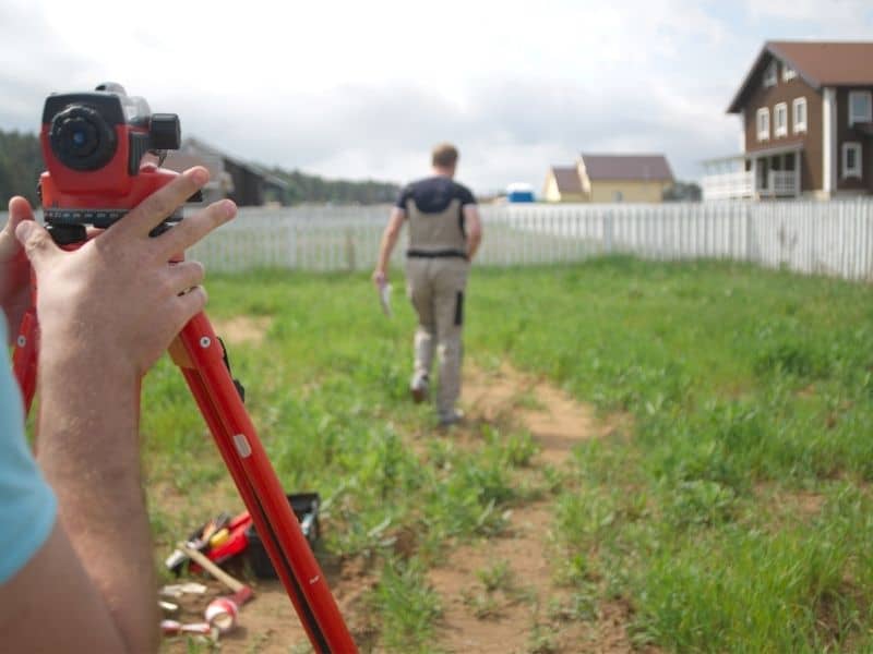
Land surveyors locating property boundaries near a residential fence before replacing an existing fence.

Replacing a fence feels like a simple home improvement project, but a boundary survey can be the one step that saves you from a costly mistake. Before you pull out old posts or sign a contract with a fence contractor, knowing exactly where your property line sits matters more than most homeowners expect.

Why Old Fence Locations Are Not Always Reliable

A fence that’s been standing for 20 or 30 years looks permanent, but its position on your lot might tell a different story. Previous owners sometimes installed fences based on guesswork, verbal agreements with neighbors, or rough estimates from an old survey. Original property markers, like iron pins or concrete monuments, can shift over time due to soil movement, lawn work, or simple neglect.

Here’s what that means for you today: the old fence line and the legal property line are often two different things. A few inches might not sound serious, but encroachments of even six inches can complicate a fence replacement project once a neighbor notices the new structure sits closer to their yard than before.

A boundary survey sends a licensed land surveyor to your property to locate the official corners and lines recorded in public land records. That’s the number you can actually build from with confidence.

How a Boundary Survey Helps Prevent Expensive Fence Reinstallation

Installing a new fence in the wrong location is an expensive lesson. If you place the fence over your neighbor’s property, even by accident, you may need to tear it down and rebuild it at your own cost. Depending on the material, that can mean losing thousands of dollars in labor and supplies.

A boundary survey done before construction gives you a verified starting point. Your fence contractor works from real coordinates instead of assuming the old fence was right. This small upfront investment can prevent you from paying twice for the same job, and it removes any guesswork from the process.

Concrete, brick, or vinyl privacy fencing costs far more than basic wood. The higher the project budget, the more a survey is worth the cost. Getting that line confirmed before a single post goes in the ground just makes financial sense.

Why Fence Replacement Projects Can Trigger New Property Questions

Neighbors who never said a word about the old fence may suddenly have opinions once they see a new one going up. That’s not unusual. An old, worn fence blends into the background. A brand-new fence draws attention, and with attention comes questions.

“Is that on the right line?” is a fair question, and one you should be able to answer. A boundary survey gives you documentation you can actually show. You’ll have a stamped survey map from a licensed professional that confirms where the fence sits relative to the legal boundary. That one document can resolve most neighbor concerns before they turn into disputes.

Without that paperwork, a disagreement over a few feet of fence line can escalate into something that costs far more to resolve than the survey ever would have.

Local Fence Rules and Setbacks Homeowners Should Understand

Most cities require fences to sit a certain distance from the property line, not directly on it. These are called setback requirements, and they vary depending on where you live, the type of fence you’re installing, and sometimes the zoning of your neighborhood.

HOAs add another layer. Some associations limit fence height, material, or style based on community rules that were agreed upon when the homes were built. Violating those rules, even unintentionally, can result in fines or forced removal.

Knowing your exact property line is the first step toward understanding how setback rules apply to your project. A boundary survey gives you that baseline. From there, you or your contractor can check local codes and HOA guidelines to confirm your fence plan is compliant before any work starts.

When It Makes Sense to Order a Boundary Survey Before Hiring a Fence Contractor

Not every fence replacement needs a full survey. Replacing a simple garden border on a well-established suburban lot with clear markers might not require one. But several situations make a survey worth scheduling before you call a contractor:

  • You’re replacing a shared fence with a neighbor and both parties want clarity on cost and placement
  • The old fence is visibly off-center or was installed without any record of where the property line sits
  • You’re upgrading to a masonry wall, vinyl privacy fence, or any higher-cost permanent structure
  • Your lot is irregular, corner-situated, or borders a public easement
  • You bought the property recently and haven’t verified the boundary locations yourself

These situations carry more risk than a basic like-for-like wood fence swap. A survey takes the uncertainty out of the project before it becomes a problem.

FAQs

Do I need a boundary survey to replace an existing fence?
A boundary survey isn’t always required, but it confirms the legal property line before a new fence goes in, which can prevent disputes and costly reinstallation.

Can I build a new fence where the old fence was located?
Not necessarily. An older fence may not have been placed on the actual boundary line, so the old position isn’t a reliable guide.

Will a boundary survey show where my new fence should go?
A boundary survey identifies the property boundaries and corner locations, which gives you the information needed to plan proper fence placement.

Can replacing a fence create disagreements with neighbors?
Yes. A new fence draws more attention than an old one, and questions about ownership or placement can come up even when the old fence never caused any issues.

Should I get a survey before hiring a fence contractor?
For shared fences, expensive upgrades, or uncertain property lines, getting a boundary survey before construction starts is generally the smarter call.

Posted in boundary surveying, land surveying | Tagged land survey

Post navigation

← Older posts
Newer posts →

Search This Site

Get Quote Button

Recent Posts

  • Construction Survey Layout for Dense Housing Projects
  • Topographic Survey Insights for Drainage Sensitive Sites
  • Boundary Survey Reviews Are Increasing Across Long-Held Properties
  • Thinking About a Backyard Addition? Get a Boundary Survey First
  • How Builders Use Topographic Surveys to Reduce Grading Costs
© Copyright Boxer Survey USA
Charlotte Land Surveyor

Charlotte, NC
Phone:(704) 285-1222

Privacy Policy | Terms of Use

Web Development and SEO by:
AuburnBusiness.com, LLC

The owner of this website, Boxer Survey USA, provides coordination of professional land surveying and engineering services in all 50 states. The professional surveying and engineering services provided to you will be conducted by fully licensed professionals in your state.

↑